
Venture Richmond Director Jack Berry gave a presentation on the proposed amphitheater at the July meeting of the Oregon Hill Neighborhood Association. One the main assertions Berry made was that the tow path on the south bank of the canal was only 12 feet wide until it was enlarged in the 1880s to make way for the railroad. He wants to remove over half of the tow path on the south bank of the canal, from 25 to 12 feet to improve the sight lines of the the proposed amphitheater.
Disproving Berry’s assertion is the 1848 plat of Lewis Harvie’s property on file at the Henrico Courthouse (Plat 3-417), which is far more detailed than the Morgan map cited by Berry. This plat is of such detail that it actually gives the dimension of the tow path as being 30 ft. wide at the location of what is now Venture Richmond’s proposed amphitheater. (See measurement on the attached Henrico Plat below the word “Path” to the left of the “House.”) The east-west street above the canal is the same width as the tow path and is also labeled “30 feet wide.”
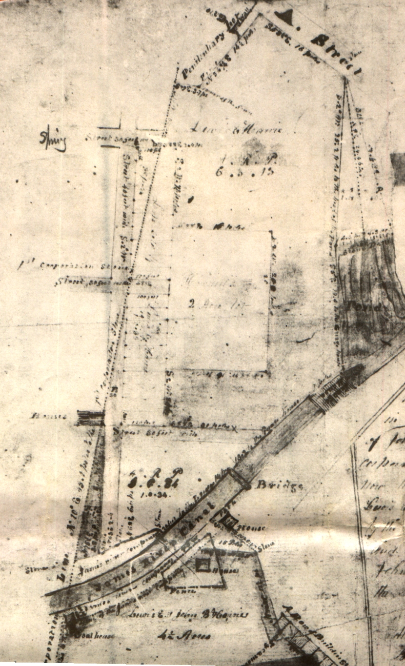
This 1848 Henrico plat establishes that the towpath was at least as wide as it is today during the canal’s primary period of significance, and long before the railroad purchased the right-of-way on the canal bank. This canal was carefully engineered with an impermeable “puddled” clay layer that would be irreparably damaged if half of the south canal bank is removed.