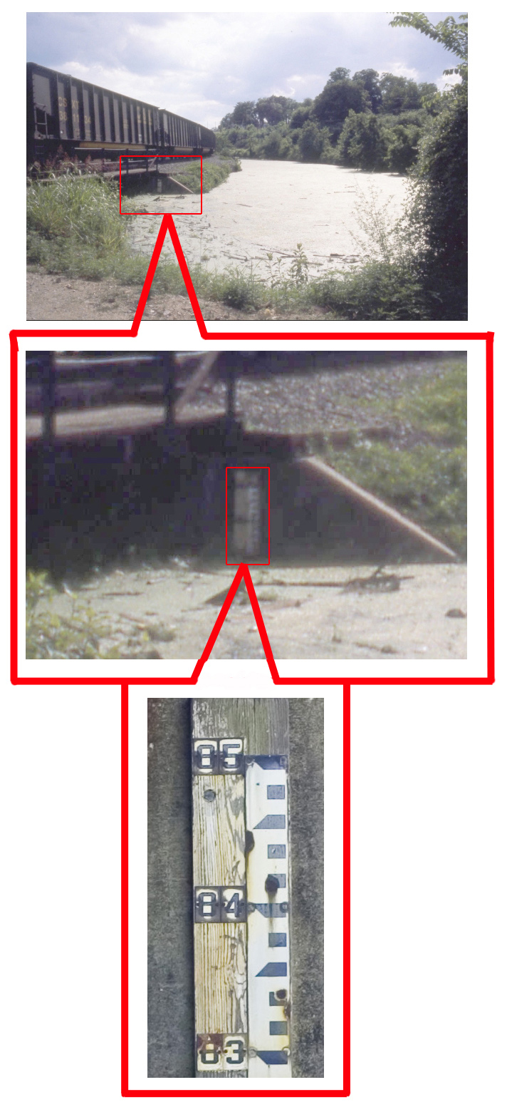
There is important new documentation on the water level in the James River and Kanawha Canal provided by the research of canal enthusiast C. Wayne Taylor. He has made the discovery that there is still a water gauge in the canal at the city Park Hydro near Cherry Street, some 1000 feet from Venture Richmond’s proposed amphitheater. The water level in the canal is clearly shown by a line on the wall at 83 feet next to this water gauge. Water has eroded all paint from the gauge under the 83 foot mark on the gauge.
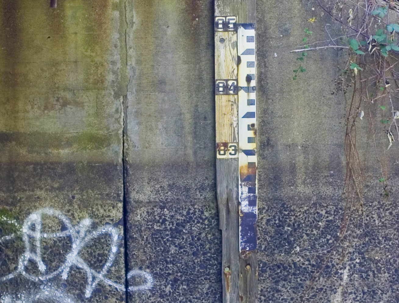
Remarkably, Wayne Taylor has also discovered a 1990s photograph from the City Planning Department in the VCU Library showing water in the canal at the location of the Park Hydro, and this photograph shows the water gauge in the canal.
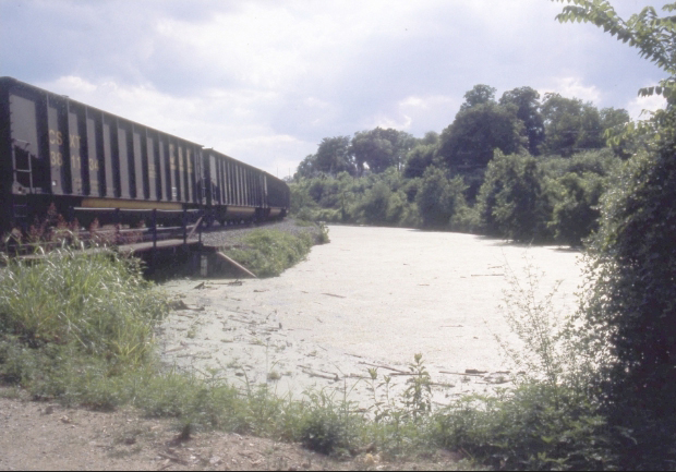
The 83 foot water elevation of the water in the canal shown in this gauge and photograph correspond with the many Tredegar and C&O Railroad surveys of the historical water level in the canal at this same location.
It would be folly to reduce the elevation of the tow path of the James River and Kanawha Canal to 83 feet as proposed by Venture Richmond, when a preponderance of evidence shows that the historical water level in the canal near the amphitheater is documented at 83 feet elevation.
When will Venture Richmond acknowledge its plan is based on flawed history? When will Venture Richmond give in to sensible compromise and stop trying to dishonorably label neighborhood concerns as unreasonable?