Neighbor Charles Pool took some photos of folks enjoying the fine weather at Belle Island today.


Neighbor Charles Pool took some photos of folks enjoying the fine weather at Belle Island today.
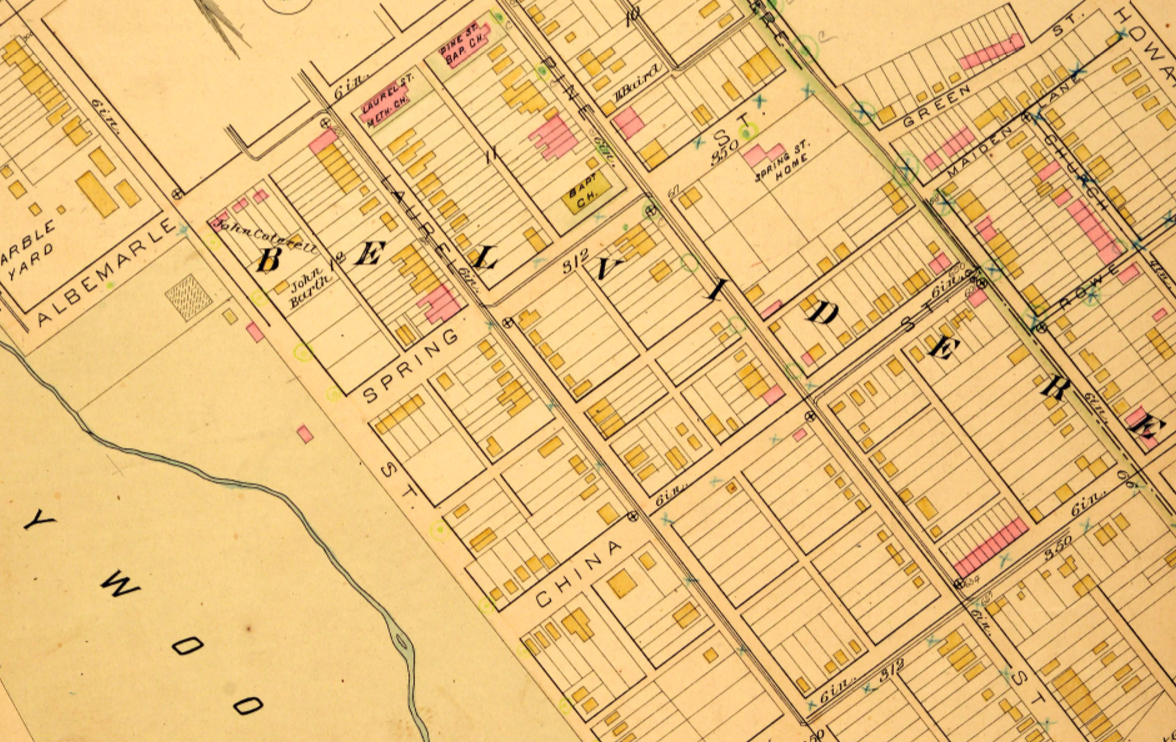
Like the more widely known early 20th century Sanborn Insurance maps, the 1889 Baist Atlas covers the entire City of Richmond in great detail, identifying frame structures in yellow, and brick buildings in red. The map above covers a portion of the Oregon Hill neighborhood south of Spring Street. This area is still referred to as “Belvidere” on the map because it was largely subdivided from the original Belvidere estate. In 1889 few houses south of Spring Street and west of Belvidere Street were made of brick, other than the Parsons House (identified as the Spring St. Home), and the row of brick houses on the 600 block of Holly Street. All of the vibrant Oregon Hill neighborhood east of Belvidere Street has been demolished, including the row of brick houses on Green Street shown on this map that were built by the infamous Ben Green.
The 1889 Baist Atlas is available for free download from the VCU Libraries digital archives:
http://dig.library.vcu.edu/cdm/singleitem/collection/bai/id/27