
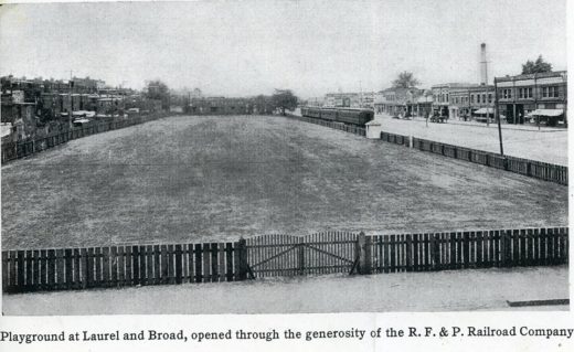
This photo shows the RF&P RR train tracks on Broad Street in the first quarter of the 20th century. This view (maybe 1915?) is westward, with the Elba train station at the rear of the view. This playground was arranged through the R.F. & P. RR by “Mrs. Bolling, of the Richmond Playgrounds Association”. It harkens to a time when Oregon Hill could sort of claim to extend to Broad Street.
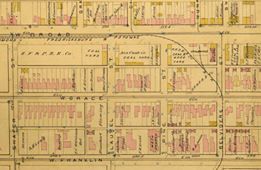
Here is part of the 1889 Baist map, which shows how the train turns from W. Broad to Belvidere then heads down past the penitentiary. The train tracks turned at Pine, thence south on Belvidere, and turned east along Byrd street, entered level, through a tunnel, to continue downtown to the old Byrd street depot.
(Special thanks to Richard Lee Bland and Fred Rodgers for the images and history notes, as seen on the Fans of Monroe Park FaceBook page.)
Very neat!