Category Archives: construction
New Bumps for New Road
Victory Rug Special Use Permit Approved
With an 11th hour agreement between the Oregon Hill Neighborhood Association and developer paving the way, the latest Victory Rug special use permit (with 12 units) passed the Planning Commission yesterday.
James River Park History
I have uncovered some of the what-ifs, but thanks to Phil Riggan for this “History of Splashy Plans for James River Parks” on Richmond.com.
Excerpt:
According to the RTD archives, there were proposals to have “water-related leisure development” on Belle Isle — Richmond’s downtown gem on the James — including an visitor’s center, ice skating rink, waterfront auditorium and a conference center. People could have gotten to the island by way of a monorail that would have connected to downtown Richmond.
The $6 million in riverfront plans at that time did not cover for the proposed monorail and other buildings on Belle Isle, which would have been paid for through private funding. Monorail screams “Disney,” right? We would have been robbed of the pleasure of walking across the Belle Isle pedestrian bridge under the Robert E. Lee Bridge, which opened in 1992. The view of the city skyline from there alone is worth any price and we’re much better off.
Something to think about as more of the area gets paved over.
Victory Not Delayed?
Oregon Hill residents are once again left wondering what is happening in City Hall.
From latest letter:
Dear Ms. Markam and Mr. Ebinger,
The Oregon Hill Neighborhood Association requests a postponement of the Victory Apt. SUP Ordinance No. 2012-200 scheduled hearing at the City Planning Commission on December 3, 2012. This postponement is necessary because two of the plans attached and referenced in the Victory Apartment Special Use Permit Ordinance No. 2012-200 are not the latest revisions that were required by the Planning Department and because the property was not posted properly per the requirements of city code Section 114-1050.5 (4).
The wrong plans have been attached to the ordinance: the latest revised Cover and A1.00 sheets of the Victory Apt. SUP are dated 10/22/12, but an earlier, incorrect version dated 9/21/12 are attached to the Victory Apt. SUP Ordinance No. 2012-200. The correct 10/22/12 revisions of the Cover and A1.00 sheets are attached to this e-mail. (Please see attachments: “Cover-SUP.PDF” and “A1.00-SUP.PDF”).
We received these 10/22/12 revisions of the Cover and A1.00 sheets as attachments to the Oct. 23rd e-mail from Mr. Ebinger below, and we were assured in the e-mail below that these revised plans would be attached to the Ordinance: “Updated plan sheets were recently provided and have been attached. The property lines for the Victory Rug Building have been modified to exclude the alley in common on Sheet A1.00 and the area of the alley in common has been excluded from the Site Data on the Cover Sheet.”
The incorrect sheet A1.00 dated 9/21/12 mistakenly shows the property line of the Victory building encroaching upon the property of the adjacent owner at 411 S. Cherry Street, as shown in the land survey of the property. (Please see attachment: “Plat of 411 S. Cherry Street.jpg”).
Unfortunately, the incorrect Cover and A1.00 sheets dated 9/21/12 are attached to the Ordinance No. 2012-200 that is being advertised and distributed by the City Clerk’s office: http://eservices.ci.richmond.va.us/applications/clerkstracking/getPDF.asp?NO=2012-200
There are substantial differences in these two versions of the plans. The incorrect 9/21/12 version of the Cover sheet notes the wrong square footage for the Site Area, Paved Area, Open Space and Usable Open Space. The incorrect 9/21/12 version of the A1.00 sheet indicates the wrong location of the property line to the south of the Victory Rug building. This error results in a 1,405 sq. ft. difference in the “Usable Open Space” available in the plan. The Planning Commission hearing scheduled for December 3, 2012 must be postponed so that the correct Cover and A1.00 sheets may be attached and referenced in the Ordinance No. 2012-200, with ample time for public review of the correct documents.
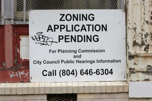
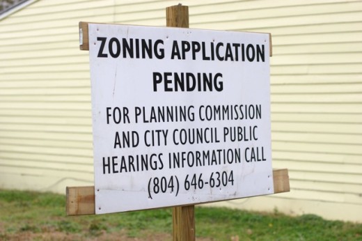
In addition, the property was not posted properly in accordance with city code Section 114-1050.5(4). The sign posted on the lot at 811 Albemarle Street is made of plastic, whereas city code Section 114-1050.5 (4) requires that, “The sign(s) shall be of wood or metal material … ” Also, much of the lettering on the sign posted at 407 S. Cherry is considerably smaller than the 3 inch letter size required by city code Section 114-1050.5 (4): “… with black lettering at least three inches in height … ” In fact, the majority of the letters on the sign posted at 407 S. Cherry are 1-1/4 inch in height, which is less than half the required size. (Please see attachments: “Sign with small lettering at 407 Cherry St.jpg” and “Plastic sign at 811 Albemarle St.jpg”).
We fear that the applicant’s non-compliance with the technical requirements of the city code regarding posting of the property may impact the community attendance at the Planning Commission. We request that both of the signs be corrected and be re-posted for the required two week period.
Additionally, we have received correspondence from residents confused by the fact that the City Council Agenda for November 26, 2012 still lists the ordinance as being heard at that session.
In summary, we request a postponement of the Planning Commission hearing scheduled December 3, 2012 for Ordinance 2012-200. The correct, revised Cover and A1.00 sheets dated 10/22/12 must be attached to the Ordinance as promised by city staff, with adequate time for public review, and the signage must be correctly posted on the property per city code.
Thank you for your consideration of this request. Please let us know as soon as possible when the Ordinance 2012-200 has been rescheduled.
Sincerely,
Charles Todd Woodson, Treasurer
Oregon Hill Neighborhood Association, inc
Planning Commission Agenda Asks for Delay on Cherry Street Project
Victory Postponed
With the elections over, neighbors are watching to see how they might effect Victory Rug building’s proposed Special Use Permit (SUP). Neighborhood leaders remain in strong opposition. The City Planning Commission’s consideration of the Victory Apt. Special Use Permit has been postponed at the developer’s request until Dec. 3. The assumption is that City Council will consider the issue the following Monday on Dec. 10.
OHNA Press Release and Corrected Press Release Over Demolished History
Following the destruction of the historic canal wall, the Oregon Hill Neighborhood Association (OHNA) put forth the following press release. Keep in mind for legal purposes, only the original issuers of press releases are responsible for verifying the accuracy of their content. Oregonhill.net, and its principals, officers and employees disclaim any liability whatsoever for inaccuracies found in the content of the press releases posted on or through the oregonhill.net website.
FOR IMMEDIATE RELEASE
Venture Richmond damages a portion of the historic James River and Kanawha Canal.
RICHMOND, VA: On Tuesday, Venture Richmond proceeded to damage a portion of the historic James River and Kanawha canal bank and to destroy a century-old brick structural component of the canal.
The Oregon Hill Neighborhood Association (OHNA) has called for the preservation of the 200 year old canal, built largely with slave labor when George Washington was the President of the canal society. The Oregon Hill neighborhood has many connections to the canal, including 601 Spring St, the former home of Samuel P. Parsons, the Canal Superintendent in 1840.
Jennifer Hancock, OHNA President, said, “We are seeing Richmond history disappear before our eyes.”
OHNA finds it disturbing that it is a public/private partnership that is responsible for the destruction. According to the Times Dispatch, Venture Richmond gets a large amount of public funding: $1.68 million from a special city tax on downtown property owners, in addition to $700,000 in public money for the Clean and Safe program.
Venture Richmond’s proposed amphitheater has ample sight lines without damaging the canal.
The Oregon Hill neighborhood has long sought the restoration of the canal to allow boats to travel west to Maymont. But the canal would not hold adequate water to float a boat to Maymont if the banks of the canal are lowered. According to archaeologist Lyle Browning, if the height of the canal bank is lowered below 82 feet above sea level, its current level, the canal will not hold enough water to allow boats to make the trip to Maymont in the future. “Lowering the height of the canal towpath without adequate archaeological investigation of the towpath will irreparably damage a nationally important resource.”
After the media started to pick the story up, Venture Richmond declared they had nothing to do with the tearing down of the canal wall. The Times Dispatch reported that Venture Richmond Executive Director Jack Berry called (the press release)”bogus” and “libelous.”
In response, OHNA released this correction this morning:
FOR IMMEDIATE RELEASE
OHNA calls for investigation into the destruction of canal property
Richmond, VA: The Oregon Hill Neighborhood Association (OHNA) acknowledges to Venture Richmond that OHNA made an incorrect assumption that Venture Richmond would be aware of bulldozers and construction crews operating on their own property, and therefore made the erroneous statement that Venture Richmond was responsible for the recent damage to the historic wall and canal.
According to an article that appeared in the October 20, 2012 edition of the Richmond Times Dispatch, “William Roberts, a project manager for J.A. Liesfeld, a Rockville-based contractor, acknowledged the firm was hired by NewMarket Corp. to tear down the wall but would not discuss the project.”
The Richmond Times Dispatch, in October 2011, reported that NewMarket destroyed another large section of the pre-Civil War Tredegar wall, only obtaining the required permit after the fact. http://www2.timesdispatch.com/news/2011/oct/07/tdmet01-richmond-officials-say-newmarket-work-was–ar-1365435/
Last Tuesday, 150 feet of brick wall constructed before the Civil War was demolished by a construction crew operating on Venture Richmond property.
“We request an investigation of whatever entity was responsible for the destruction of this historic property,” said Jennifer Hancock, OHNA President. “Whoever demolished this wall should be required to rebuild the wall.”
The James River and Kanawha Canal was built over 200 years ago largely with slave labor when George Washington was president of the canal society. The Oregon Hill neighborhood has many connections with the rich history of the canal.
Some facts worth noting: NewMarket is listed as a major contributor to Venture Richmond. Two NewMarket executives sit on the Venture Richmond Board, including NewMarket’s CEO Gottwald. NewMarket a few weeks ago gave Venture Richmond the property for the amphitheater where much of the damage took place.
At the same time, according to sources, NewMarket is now contradicting the Times Dispatch to say that NewMarket had absolutely no role in the demolition of the wall located on the City’s property.
Another fact to keep in mind- the City Council 5th District’s boundary was slightly altered earlier this year to include the 2nd Street area.
The City’s new Riverfront Plan should be coming up at City Council very soon. It’s worth remembering that citizens spoke at planning meetings in favor of renovating the Kanawha Canal as a priority of this Riverfront Plan.
Oregon Hill residents have contacted the City’s Commonwealth Attorney to see how the criminal investigation is going. Stay tuned…
Despite Opposition, 2nd Street Connector Construction Starts
Despite opposition from the Oregon Hill Neighborhood Association, the Sierra Club Falls of the James, citizens, as well as open government concerns, the City is pushing ahead with construction of the 2nd Street Connector.
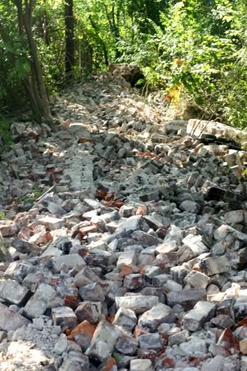
Yesterday, despite promises for full exploration of the historic significance of the site, over 150 feet of century old structural canal brick wall was destroyed.
From City press release:
Construction on Richmond’s new street that will connect Second Street to Tredegar Street on the north side of the James River downtown will have a minimal effect on visitors to the James River Park’s Belle Isle who park in the Tredegar Street lot.
The first or eastern entrance to the lot on Tredegar Street will be closed effective Tuesday, October 16, due to construction on the new connector street; however, the second or western entrance to the lot, as well as the entire lot itself, will remain open throughout the entire construction period.
Survey of Cherry Street (What Now, Victory Rug?)
The Oregon Hill Neighborhood Association (OHNA) has repeatedly pointed out that the 400 block of S. Cherry is too narrow to support parking on both sides of the street as proposed by the Victory Apartments Special Use Permit application. The VDOT minimum standard is 28 feet for a residential street with parking on both sides. This land survey definitely shows that the street is too narrow for parking on both sides of the street, narrowing from 26.41 feet at the Victory Rug building to 23.23 feet at the top of the hill.


![2012-10-09 S Cherry St Survey[1] copy](https://www.oregonhill.net/wp-content/uploads/2012/10/2012-10-09-S-Cherry-St-Survey1-copy-315x520.jpg)