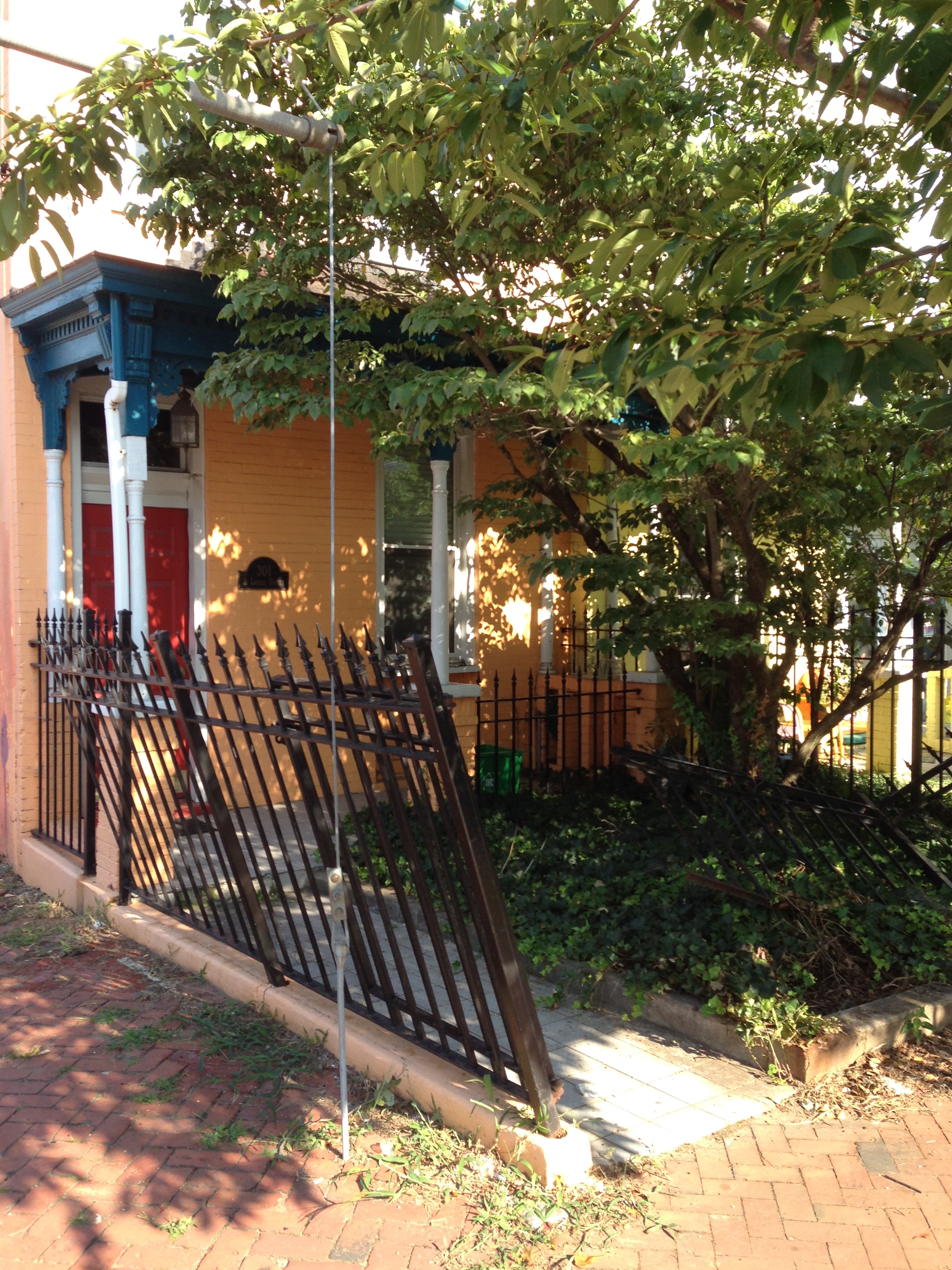
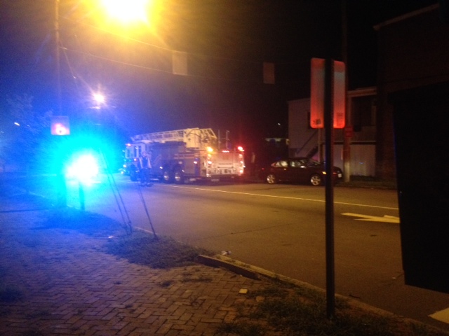
E-ZPass Program Ends Monthly Fee

Call me old-fashioned, but I still pay the 195 tolls with coins. However, for those that do use E-ZPass, the monthly fees for it will end:

Dear Valued E-ZPass Virginia Customer,

I am pleased to inform you that as of July 1, 2014, Virginia’s E-ZPass program will no longer charge a monthly maintenance fee on transponders. In April 2014, Governor McAuliffe signed legislation that required the elimination of the monthly maintenance fees by September 1, 2014. At the Governor’s direction, we are implementing this change two months early.

In the coming days, you will receive more details regarding the terms and conditions of Virginia’s E-ZPass program. We will continue to look for opportunities to improve the program and appreciate your participation in E-ZPass Virginia.

www.ezpassva.com
This email was sent from customerservice@ezpassva.com

Higher Speeding Fines For W. Cary Street

City Council passed a measure on Monday that places higher fines on speeders on West Cary Street between Addison and Cherry streets near VCU – an additional $200 fine for speeding.

From an earlier article on WRIC:

The speed limit in that residential stretch is supposed to be only 25 miles per hour, yet neighbors say they saw drivers appear to be going much faster.

Mark Brandon with the uptown association has been working with the city for nearly 20 years to find a solution.

“An accident in this intersection could go right up into people’s houses,” he says. “Being a city, our houses are close to the curbs.”

City Councilman Parker Agelasto has proposed a solution: a $200 additional fine on top of a speeding ticket. Many neighbors like the idea.

Agelasto says that 85 percent of drivers on that street go at least 10 miles an hour over the speed limit. According a city ordinance, the street is eligible for the fine increase, which is actually one of the most inexpensive ways to calm traffic in the area.

“For now, it could be very helpful. Cary St gets a lot of traffic, downtown, at high speeds, mostly in the morning.”

‘Tredegar Green’ Yesterday Afternoon

While City Council was busy figuring out how to give away Richmond’s oldest PUBLIC park, I was doing some walking down at the riverfront. I was disgusted by what I saw:

IMG_3111IMG_3112

Cars are parked right next to the historic Kanawha Canal. Trash everywhere. Venture Richmond, the property holder, has allowed this very important historical site to become a trashy parking lot! Will there be any repercussions this time?
It is outrageous that the City government wants to give them tax exemptions on the land and let them build an unneeded amphitheater.

This is what happens when you have a corporate government that is not accountable to the public.

Traffic Impact Briefing for Collegiate Races May 2-4

From Councilperson Parker Agelasto:

Dear all,

I am passing along information about the 2014 USA Cycling Collegiate Road National Championship occurring May 2 – 4. There will be road closings affecting the northeastern portion of the 5th District. Please note that the provisions that have been recommended to accommodate for ingress and egress from neighborhoods. Oregon Hill will be most affected and will gain access by the temporary conversion of 2nd Street to two-way.

Please feel free to distribute this information to your civic association members as I am certain they will want to know.

Many thanks,
Parker C. Agelasto
Richmond City Council, 5th District

Click here for full Power Point file- 4.8.14 Traffic Impact Presser_v2

Screen Shot 2014-04-11 at 12.22.41 AM copy

OHNA Against The Shockoe Stadium Proposal

The Oregon Hill Neighborhood Association (OHNA), at its February meeting, voted to oppose the Shockoe stadium proposal, due to the questionable finances and the possible destruction of important Richmond history.

OHNA meets again tomorrow evening at 7 pm at the William Byrd Community House. At 8 pm the meeting will focus on planning for the Idlewood roundabout project.

Idlewood Avenue History

Neighbor Todd Woodson continues to help with the Idlewood traffic project.

He recently sent this to the committee members:

While we are awaiting design updates from our friends at Kimley – Horn, I thought i’d share some of the background of the area we are working to improve. Since a picture is worth a thousand words, i’ll simply start with a grid map from the 1924 Sanborn map (thanks, C Pool!). As you can see, the downtown expressway destroyed the northern portion of grid seen here. Harrison and Idlewood (also known as Beverly street) remain as they were laid out. The pink highlighter is a rough approximation of the exit ramp and Grayland redux surrounded by Harrison and Idlewood as they exist today. The second shot is a 1976 photograph of the downtown expressway right before it opened (looking east from where the toll booths would be today). This amenity truly fractured the Randolph and Oregon Hill neighborhoods and splintered our communities. We lost a total of 700 residences and experienced 150 business relocations from the expressway…

(RRHA owns the pie shaped parcel bordered by Harrison, Idlewood and Grayland.)

map of roundabout area
safe_image

Hero Performs CPR At Motorcycle Wreck On Belvidere

Yesterday afternoon there was a severe collision between a car and motorcycle at Belvidere and Spring Streets.

From the NBC12 article:

“A woman was driving north on Belvidere when she hit the motorcycle around 3 p.m. while attempting to turn left onto Spring Street, officers said.”

The motorcyclist is in the hospital with life-threatening injuries, but according to reports he is still alive in part due to a good samaritan who stopped and gave the man CPR until paramedics arrived.