Guerrilla Warfare During The Civil War Event On Thursday

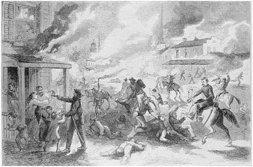
The Tredegar Society, “an association of young professionals who come together to promote and further the goals of the American Civil War Museum”, is presenting an event on Thursday called “Guerrilla Warfare During The Civil War”.

From the FaceBook event page:

Join us for a discussion with Dr. Barton Myers of Washington & Lee University, highlighting the role guerrilla warfare played during the Civil War. The $10 ticket includes beer/wine and light snacks during the reception from 6:00pm to 6:45pm. The talk will begin at 6:45.

11822279_955200267851632_5515795241250027885_n

Pratt’s Castle

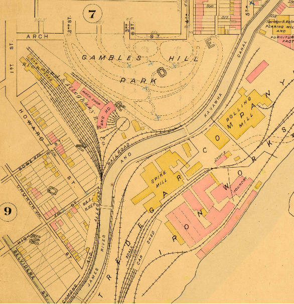
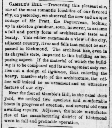
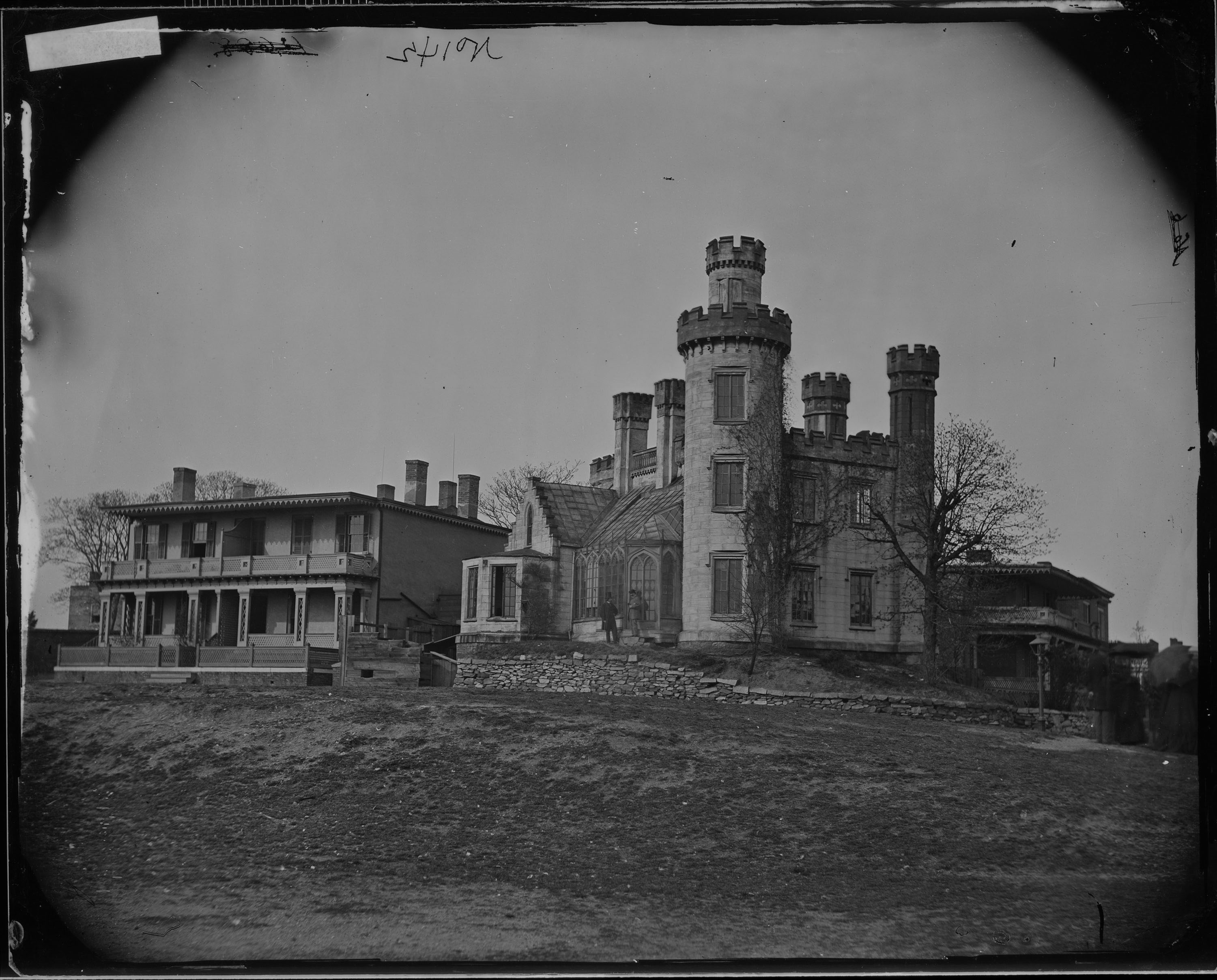
Quite visible from Oregon Hill was one of the most celebrated buildings of Richmond, known as Pratt’s Castle (Folly or Cottage). This building with crenelated towers was constructed on Gamble’s Hill above the Penitentiary Basin by a master of the daguerreotype, William Pratt. An article in the Daily Dispatch from February 1853 records that the unusual edifice was under construction: “[W]e observed the new and unique cottage of Mr. Pratt, the Daguerrean, looking up in skeleton grandeur … The architect has, even in its chrysalis state, imparted to this building an imposing aspect.” This reporter also notes that two “spacious and comfortable” canal boats were being built in the Penitentiary Basin below Gamble’s Hill.

A later article in the Times Dispatch from May 1904 details the rich contents of the castle, lately owned by Samuel Cornick and his wife Hennie, the daughter of Mayor Joseph Mayo. All of the extensive art work, silver, china and diamonds were being sold, including, “25 tons of coal, stores of provisions sufficient to withstand a siege of famine …”

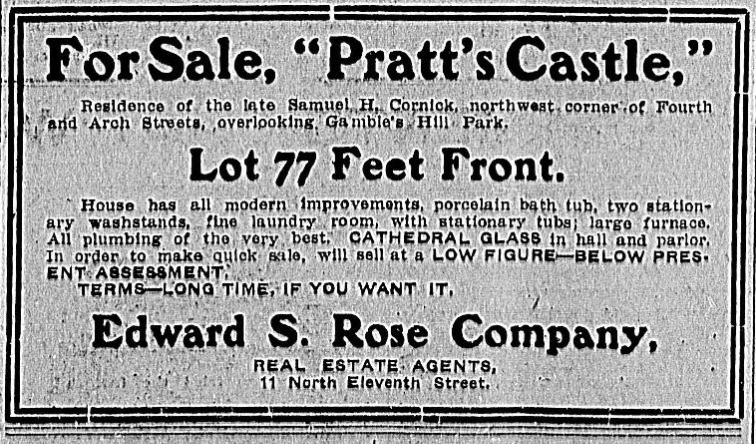
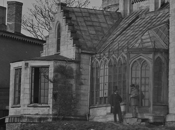
An advertisement for the sale of the castle in 1906 highlights the “cathedral glass” in the hall and parlor. This cathedral glass is notable in the 1865 photograph (detail) of Pratt’s Castle taken by Matthew Brady, found in the National Archives.

In 1958, Ethyl Corporation demolished Pratt’s Castle, one of Richmond’s most distinctive buildings, over the strong objections of Richmond’s preservationists. Around 1983, Ethyl Corp. traded Brown’s Island on the flood plane for the city’s prominent Gamble’s Hill Park with spectacular river views.

Photo credits:
Daily Dispatch, February 4, 1853, Library of Congress
Times Dispatch, July 1, 1906, Library of Congress
Pratt’s Castle, by Matthew Brady, National Archives
Pratt’s Castle, by Matthew Brady (detail), National Archives
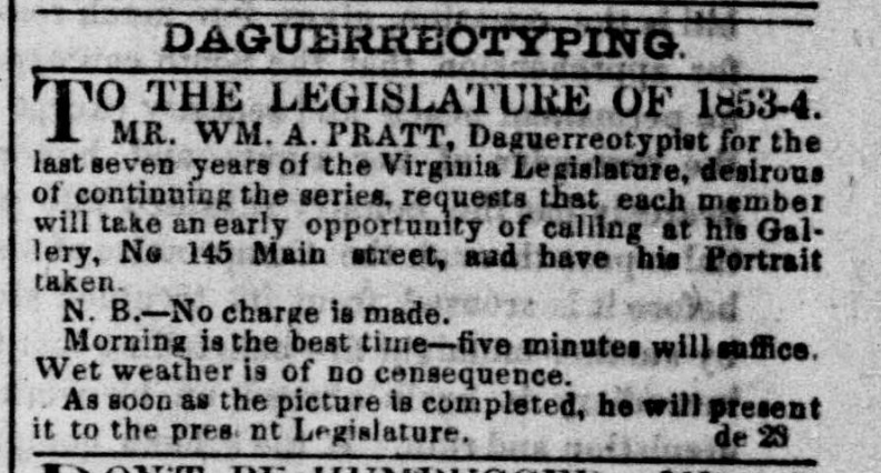
Pratt advertisement, February 6, 1854, Daily Dispatch, Library of Congress
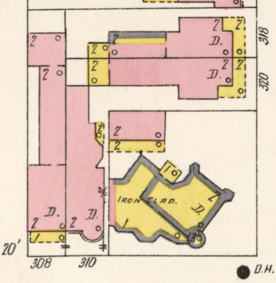
Pratt’s Castle, 1905 Sanborn map, Library of Congress

Pratt's Castle, Feb 4  1853, Daily Dispatch copyPratts Castle, July 1 1906 Times DispatchPratt's Castle (detail) National ArchivesPratt's Castle, National ArchivesPratt advertisement Feb 6 1854 Daily DispatchPratt's Castle on 1905 Sanborn map

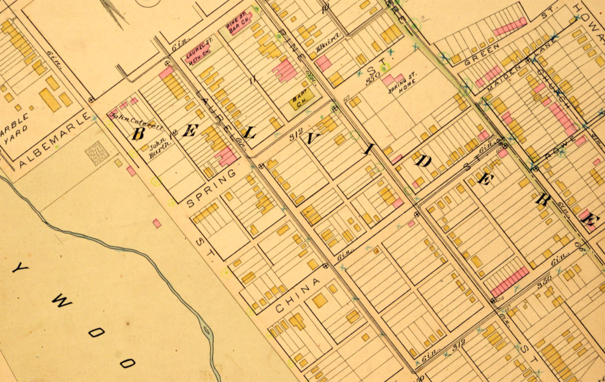
1889 Baist Atlas

Like the more widely known early 20th century Sanborn Insurance maps, the 1889 Baist Atlas covers the entire City of Richmond in great detail, identifying frame structures in yellow, and brick buildings in red. The map above covers a portion of the Oregon Hill neighborhood south of Spring Street. This area is still referred to as “Belvidere” on the map because it was largely subdivided from the original Belvidere estate. In 1889 few houses south of Spring Street and west of Belvidere Street were made of brick, other than the Parsons House (identified as the Spring St. Home), and the row of brick houses on the 600 block of Holly Street. All of the vibrant Oregon Hill neighborhood east of Belvidere Street has been demolished, including the row of brick houses on Green Street shown on this map that were built by the infamous Ben Green.

The 1889 Baist Atlas is available for free download from the VCU Libraries digital archives:
http://dig.library.vcu.edu/cdm/singleitem/collection/bai/id/27

1889 Baist Atlas, VCU Archives

Sanborn Insurance Map

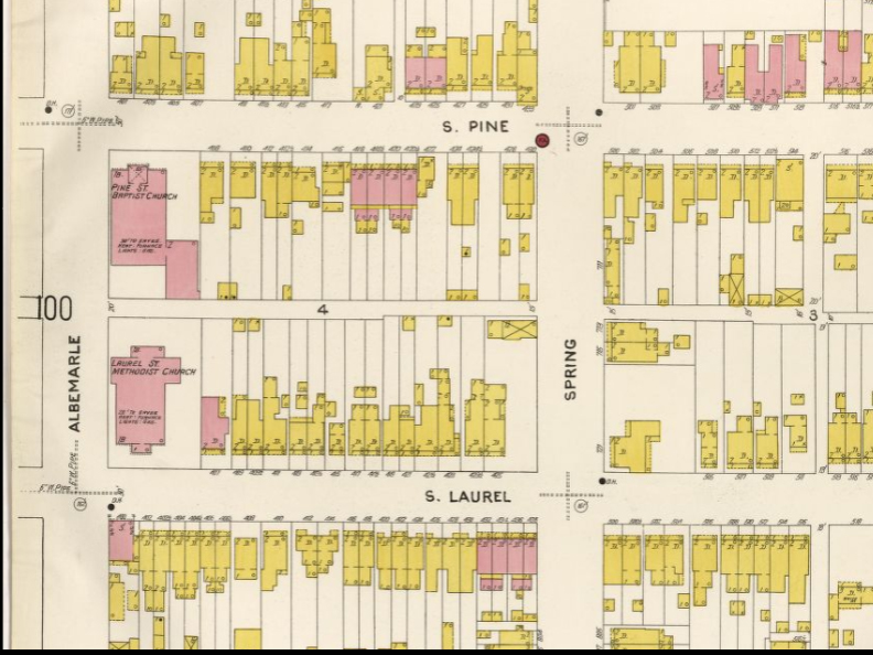
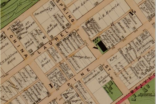
The Sanborn insurance maps are a wonderful resource for researching buildings in Oregon Hill and the City of Richmond. The Sanborn maps were very detailed, showing frame buildings in yellow, brick buildings in red, and stone buildings in blue, with notations of the number of stories and building additions. For example in the detail above we see that the Laurel Street Methodist Church, at the corner of Laurel and Albemarle Streets, was made of brick 28 feet in height to the eaves, had a basement and gas lighting. The Sanborn maps were revised from 1905 through 1925 and the 1905 version is available for free on the Library of Congress web site: http://www.loc.gov/

Photo credit: Library of Congress
Sanborn Ins map, 1905, Library of Congress

1876 Beers Atlas

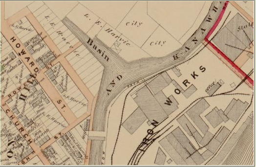
A very useful map for anyone studying the history of Oregon Hill and Richmond is the 1876 Beers Atlas. This very detailed atlas identifies the names of the property owners and shows the building footprints. For example, the detail above shows that the Baptist Church in 1876 was on the opposite corner of the 400 block of S. Pine Street, and that the Samuel Parsons House at 601 Spring Street was then known as the Spring Street Home. The Illustrated atlas of the city of Richmond, Va. / by F.W. Beers is available for free on the Library of Congress website (much of Oregon Hill is shown on Section P of the map): http://memory.loc.gov/
Photo credit: Library of Congress

Beers Atlas, 1876, Library of Congress
1867 Mitchie/Micheler Corps of Engineers map

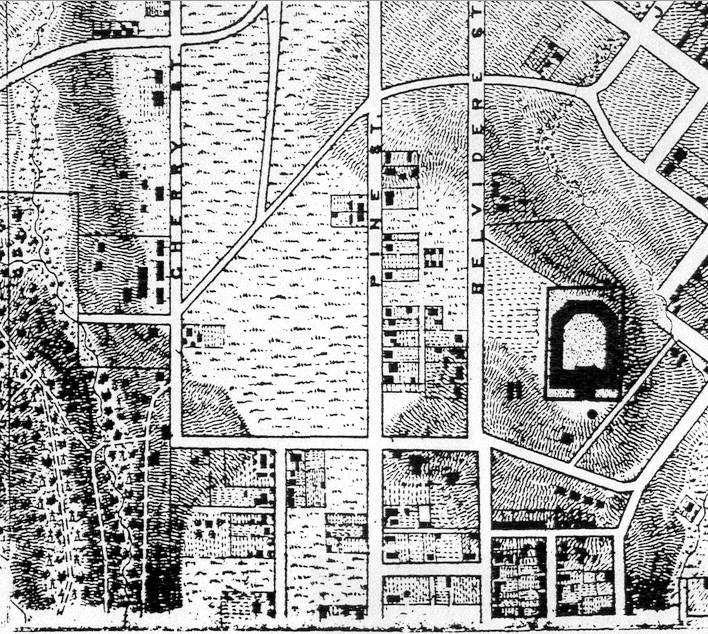
The 1867 Mitchie/Micheler Corps of Engineers map shows the buildings and topography of the entire Richmond area. The attached small detail from the huge map shows a portion of the Oregon Hill neighborhood between the horse-shoe shaped Penitentiary on Spring Street on the right and Hollywood Cemetery on the left. This map shows many homes that were built in Oregon Hill by the Civil War. These houses typically were small workers’ dwellings with gable roofs. Quite a bit of development is shown south of Spring Street, probably because much of this area of the neighborhood was included in the Belvidere estate, which was subdivided around 1817.

Much of the 1867 Mitchie/Micheler map has been placed on the Civil War Richmond website, available for free download:
http://www.mdgorman.com/Maps/1867_engineers_map_of_richmond.htm

Photo credit: Civil War Richmond website (from original map in the National Archives)

1867 Corps of Engineers map, Michie-Micheler (detail)

Oregon Hill Walking Tour On Sunday

From the Valentine Museum/Richmond History Center:

June 21, 2-4 p.m.
Oregon Hill Walking Tour
Oregon Hill originated as a grouping of residences for workers from the Tredegar Iron Works and survives today as a tight-knit working class enclave that has continued to thrive with remarkable cohesion. Learn about its history and newer developments on this tour of the neighborhood. Meet at Laurel and Idlewood streets.

Oregon Hill in April 1865

At the conclusion of the Civil War, the U.S. military telegraph troops were photographed in Oregon Hill in April 1865 with their covered wagons. The many tents and temporary stables shown near the houses on the 100 block of S. Cherry suggest that these troops were bivouacked in Oregon Hill. The photographs were taken from the vantage point of looking north towards West Cary Street, with the rear of the William Smith House, which has survived at 611 W. Cary Street, shown in the detail. Very high resolution copies of these two photos can be downloaded for free from the Library of Congress website:
http://www.loc.gov/pictures/item/2013647869/
http://www.loc.gov/pictures/item/cwp2003000706/PP/

Photo credits: Library of Congress
US Military Telegraph Corps, 1865 (1)US Military Telegraph Corps, 1865 (2)William Smith House,  611 W Cary, detail

ASL Tour Of Hollywood Cemetery Thursday

The ASL Walking Tour of Hollywood Cemetery this Thursday will share some interesting facts about Jefferson Davis’ son, Billy, who was hard of hearing and about the Davis’ family connection to renowned deaf artist John Carlin.Dr. Pajka will also be discussing American novelist Ellen Glasgow who communicated largely via writing due to her deafness.

This walking tour will be given in American Sign Language and will not be voice interpreted. The tour will begin at 9:00am. This is a walking tour of approximately two miles, so please dress for weather and walking. We ask that participants make a $15 contribution to Friends of Hollywood Cemetery.

For more information, please visit the FaceBook event page or the Hollywood Cemetery event reservation page.